 We got home late this evening because everything we did was late. We got the car inspected and our appointment was 4:00 at the garage. After that, we went to the bank, then the post office and then beat feet to Lee’s Chiropractic office in Tannersville. While up there (after the appointment) we snapped a few pictures on Platte Clove Road, which is closed near the head of the clove because the road gave way in a rain storm and collapsed down the side of the mountain. They are now fixing it, which will take about a month, they think. We went to a spot where you can look up Gooseberry Creek which is one of the little head water streams of the Schoharie Creek which runs all the way to the Mohawk River, and is impounded twice north of Prattsville to create New York City's Schoharie Reservoir and the Blenheim-Gilboa Power Project. The Schoharie Creek is unique because it flows north, as opposed to south, which seldom happens. Anyway, here are a few pictures of the Tannersville, Hunter Mountain Ski Resort and the Schoharie Creek.

This is Gooseberry Creek, one of the head waters of the schoharie Creek near Tannersville.

Looking over Plateau Mountain and Sugarloaf Peak.

Looking at the Hunter Mountain Ski Resort (elev. 4046 feet)

A picture of the ski resort facility.

Hunter Mountain Resort & Ski Lift

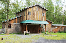
Horse Riding farm (Black Bear Restaurant) on route 214 @ Tannersville.
We also took a few of the road and mountain coming down through the Kaaterskill Clove. Now there is a place that is a beautiful and rugged as any place on this green earth.

Heading down through the Kaaterskill Clove from Haines Falls.

Nearing the curve just above "Bastion Falls", in the Kaaterskill Clove.

This view of "Bastion Falls" is visible from route 23A on the curve.

To see this you must go to Laurel House Road in Haines Falls. I took this standing on the edge of the 265 foot drop. BEAUTIFUL!!!!!

Approaching "Fawns Leap" near the bottom of the clove road.


No comments:
Post a Comment